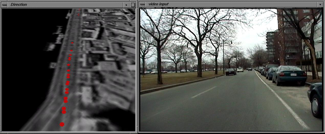
The top two images are windows from a working demo of our prototype DataCam here at the lab.
The prototype camera encodes its data onto an audio channel on a Sony DV video camera. As we
play back the video on the right side window, we decode the GPS data and plot it
onto a sky view of the area. In this case the right side is video footage taken from a
bike ride through Cambridge, which one follows in a helicopter fly by on the left side.
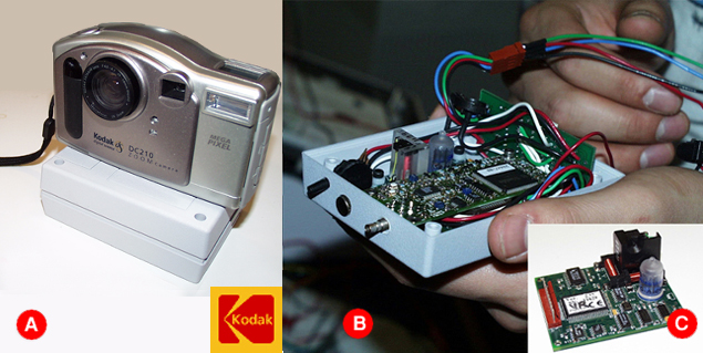
 attached to each of the cameras carried by the climbers and members of
our team are small "black boxes" (in this case gray).
attached to each of the cameras carried by the climbers and members of
our team are small "black boxes" (in this case gray). inside each box is a Trimble GPS receiver (front) to get the latitude
and longitude that each picture is taken at via satellite signals, and
inside each box is a Trimble GPS receiver (front) to get the latitude
and longitude that each picture is taken at via satellite signals, and a Precision Navigation, Inc. digital compass, to determine the direction the camera is facing.
The cool "bubble" piece senses inclination.
a Precision Navigation, Inc. digital compass, to determine the direction the camera is facing.
The cool "bubble" piece senses inclination.